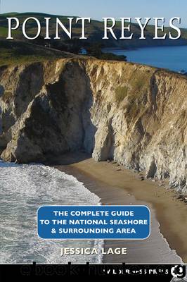
Point Reyes Complete Guide by Lage Jessica;

Author:Lage, Jessica;
Language: eng
Format: epub
ISBN: 537931
Publisher: Wilderness Press
Published: 2004-09-15T00:00:00+00:00
Fog can create up to 10 inches of precipitation a year on Inverness Ridge. In summer, moisture dripping from tree cover and tall grasses often makes the trail as muddy as after a winter rain.
As you head toward the ocean along the crest of Inverness Ridge, Douglas-firs tower above and light-green lichen, nurtured by thick summer fogs and rainy winters, hangs from their branches. Western sword fern, red elderberry, and evergreen huckleberry adorn the trailside. You descend to a small clearing, surrounded by high trees, and strike out for the coast on the Woodward Valley Trail. Across the meadow, the trail enters a dense alley of small Douglas-fir trees and soon begins its mostly descending route. On a delightful and varied course, you pass through shaded forest and open coastal-scrub vegetation of sticky monkeyflower, coyote bush, ceanothus, blackberry, and wild cucumber. Charred tree trunks remain standing among vigorous new growth.
From the Woodward Valley Trail, you have a good view of the burned tree trunks that dot the coastal slopes, evidence of the 1995 Vision Fire. The fire enveloped 12,354 acres surrounding Mt. Vision, burning 45 homes and 15 percent of Point Reyes National Seashore. Although the burnt trees are the only obvious remnant, the vibrant growth that surrounds them also resulted from the fire.
Your first view of the ocean, appearing suddenly beyond the folds of the coastal slopes, may take your breath away. Even more spectacular views emerge after a brief climb to a small knoll, where youâll see south to Double Point and north to Chimney Rock. The trail wraps around to the western side of the knoll, and begins to descend an eroded path. You soon turn left on the Coast Trail (5.2 miles from the trailhead), a former ranch road that travels the ancient marine terrace a couple of hundred feet above the ocean. On this level, step-like stretch of land, you follow the Coast Trail south for 3 miles. Coyote bush, blackberry, wild cucumber, tall bushes of ceanothus, and low-growing grasses flank the trail, and in spring, the blue blossoms of Douglas iris put on an elegant show, accompanied by small yellow sun cups and pink checkerbloom.
A spur path to Sculptured Beach shortly branches right, marked by a small sign almost hidden among ceanothus bushes (see side trip). After 2 miles or so, you pass the shale promontory of Point Resistance, where offshore rocks attract pelagic birds like common murres. Continuing on, you reach a large eucalyptus, the last remnant of Y Ranch, and an access trail to Kelham Beach (see side trip). Cross a bridge over a small creek that drains from the ridge to the ocean. About half a mile beyond, you pass the Sky Trail and, in another half a mile, reach the Bear Valley Trail near Arch Rock (8.6 miles from the trailhead).
Download
This site does not store any files on its server. We only index and link to content provided by other sites. Please contact the content providers to delete copyright contents if any and email us, we'll remove relevant links or contents immediately.
Giovanni's Room by James Baldwin(5901)
The Plant Paradox by Dr. Steven R. Gundry M.D(2053)
The Stranger in the Woods by Michael Finkel(1934)
Miami by Joan Didion(1885)
DK Eyewitness Top 10 Travel Guides Orlando by DK(1823)
Vacationland by John Hodgman(1781)
Trail Magic by Trevelyan Quest Edwards & Hazel Edwards(1765)
Wild: From Lost to Found on the Pacific Crest Trail by Cheryl Strayed(1751)
INTO THE WILD by Jon Krakauer(1733)
The Twilight Saga Collection by Stephenie Meyer(1729)
Nomadland by Jessica Bruder(1694)
Birds of the Pacific Northwest by Shewey John; Blount Tim;(1611)
Portland: Including the Coast, Mounts Hood and St. Helens, and the Santiam River by Paul Gerald(1586)
The Last Flight by Julie Clark(1506)
On Trails by Robert Moor(1487)
Deep South by Paul Theroux(1482)
Trees and Shrubs of the Pacific Northwest by Mark Turner(1434)
Blue Highways by William Least Heat-Moon(1385)
1,000 Places to See in the United States and Canada Before You Die (1,000 Places to See in the United States & Canada Before You) by Patricia Schultz(1303)
